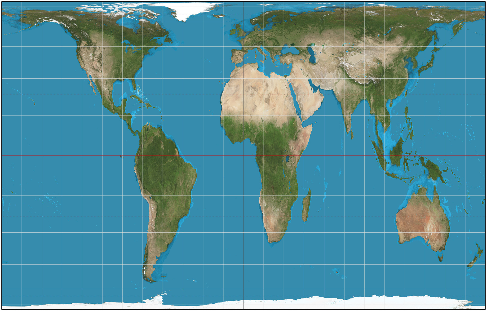
The Gall-Peters projection map, showing the true relative size of the continents without the distortion of the traditional Mercator projection. (As usual, “The West Wing” got there first.)
Official website of the author
The Gall-Peters projection map, showing the true relative size of the continents without the distortion of the traditional Mercator projection. (As usual, “The West Wing” got there first.)
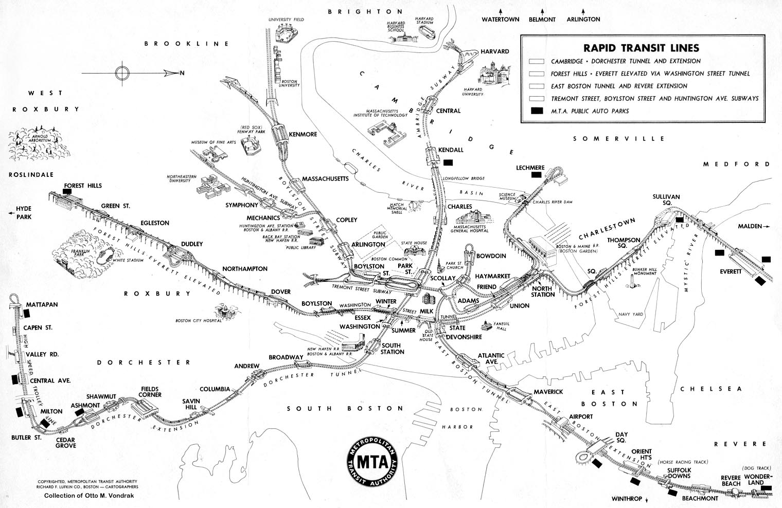
Click image to view full size. Via Cartographia.
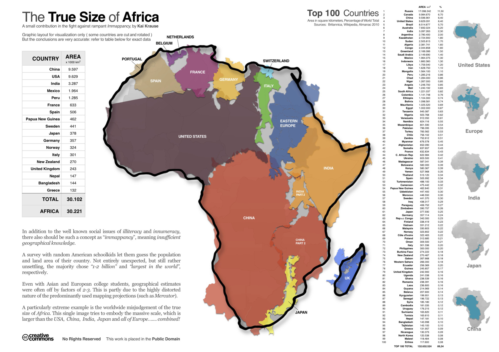
Africa is larger than the U.S., China, India, Japan, and all of Europe combined. Via (click to view full size).